New Orleans gets most of the attention in Louisiana, and deservedly so, but the rest of the state tells a fuller story: a capital city on the Mississippi, Cajun country in the south-west, one of the oldest towns in the region, and a vast swamp wilderness that feels like another world. Travelling beyond New Orleans also means quieter roads, lower prices and a closer look at how Louisiana actually lives.
This guide covers the places worth the drive, what each one does best, and how to string them together into a sensible trip.
Baton Rouge: The Capital on the River
Baton Rouge sits on a bluff above the Mississippi River, and its skyline is dominated by the Louisiana State Capitol, a 34-storey Art Deco tower that is the tallest state capitol building in the United States. The observation deck gives a clear view of the river and the city, and it is a good first stop for orientation.
Nearby, the Old State Capitol is a striking Gothic Revival building that now houses a museum about Louisiana’s political history. Between the two, the downtown riverfront, the USS Kidd veterans museum on the river, and the Louisiana Art and Science Museum make an easy half-day on foot. For a quieter break, the gardens at the LSU Rural Life Museum, just outside the centre, show how rural Louisiana life looked in the 19th century.
Lafayette and Cajun Country
Lafayette is the heart of Cajun country, where French-speaking Acadian settlers shaped the food, music and language of south Louisiana. Vermilionville, a living-history village on the Bayou Vermilion, recreates Acadian homes and workshops and explains that history far better than a plaque can. In the evening, look for a local dance hall or restaurant with live Cajun or zydeco music — that is where the culture is still lived, not just displayed.
Food is central here: crawfish étouffée, gumbo, boudin and po’boys are everyday dishes, not tourist novelties. Ask locals where they eat rather than following the busiest menu board. South of Lafayette, the small towns of Breaux Bridge and St. Martinville are worth a slow drive, with antique shops, bayou views and a much quieter pace.
Natchitoches: Louisiana’s Oldest Town
Founded in 1714, Natchitoches is the oldest permanent settlement in the Louisiana Purchase territory, and its brick main street along Cane River Lake still feels like a small Southern town rather than a museum piece. The historic district is walkable, with bed-and-breakfasts, cafés and shops in restored buildings.
The town is best known for its Christmas Festival of Lights in winter, when the riverfront is lit for weeks, but it is a pleasant stop at any time of year. Nearby, the Cane River Creole National Historical Park preserves plantations and outbuildings that tell a more complete — and sometimes difficult — story of the region’s history, including the lives of enslaved and free people of colour who worked there. Visit with that context in mind.
The Atchafalaya Basin: Swamps, Bayous and Wildlife
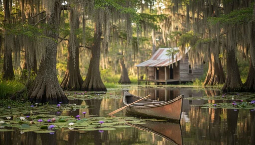
The Atchafalaya Basin is the largest wetland and swamp in the United States, a maze of bayous, lakes and flooded forest between Baton Rouge and Lafayette. A guided swamp tour is the easiest way to see it: guides know where alligators, herons, egrets and other wildlife are likely to be, and they explain how the basin’s water levels shape everything that lives there.
Kayaking is possible for confident paddlers, but go with a guide unless you know the waterways — channels look alike, weather changes quickly, and alligators are a real presence. Spring and autumn offer the most comfortable weather; summer is hot, humid and buggy, so bring repellent and water even on a short tour.
Plantation Country and the River Road
Between Baton Rouge and New Orleans, the River Road follows the Mississippi past former sugar plantations, some now open as museums. These visits work best when they present the full history, including slavery, rather than only the grand houses. Check what each site covers before you go, and allow time to read the exhibits rather than rushing through for photographs.
If you are driving this route, plan for a full day and stop in small river towns along the way. The road itself, with levees, cane fields and river views, is part of the experience.
Planning a Trip Beyond New Orleans
A car is essential outside New Orleans; public transport between these towns is limited. A practical loop is New Orleans to Baton Rouge, then west to Lafayette and the Atchafalaya Basin, then north to Natchitoches, returning via Shreveport or back down the interstate. Allow at least four to five days for that loop without rushing.
Spring and autumn are the most comfortable seasons. Summer brings heat, humidity and afternoon storms; winter is mild but can be damp. Book accommodation in Natchitoches and small Cajun towns ahead during festivals, when rooms fill quickly. For a wider sense of the region’s history, our guide to the top historic places to visit in the US puts Louisiana’s towns in national context, and our road trip itinerary guide helps turn this loop into a day-by-day plan.
FAQ:
How many days do you need outside New Orleans?
Three days covers Baton Rouge and Lafayette; five days lets you add Natchitoches and a proper swamp tour without long driving days.
Is Louisiana safe for a road trip?
The main routes and towns in this guide are well travelled. Take normal road-trip precautions: keep valuables out of sight, check weather before swamp or boat trips, and avoid driving tired on long rural stretches at night.
What food should visitors try?
Crawfish étouffée, gumbo, jambalaya, boudin and po’boys in Cajun country, plus meat pies in Natchitoches. Portions are generous; sharing plates is common.
When is the best time to visit Louisiana beyond New Orleans?
March to May and October to November offer the most comfortable weather and the fullest festival calendar. Summer is hotter and more humid but quieter.
Final Thoughts
Louisiana beyond New Orleans rewards travellers who slow down: a capitol tower view in Baton Rouge, a dance hall in Lafayette, a quiet brick street in Natchitoches, and a morning on the bayou. Together they give a truer picture of the state than any single city can.